Marine and Coastal Biodiversity Management in Pacific Island Countries – MACBIO
OBJECTIVE
- Manage and conserve biodiversity in marine and coastal ecosystems by strengthening institutional and individual capacity
- Support sustainable economies and livelihoods of Pacific Island Countries.
Targeted beneficiaries
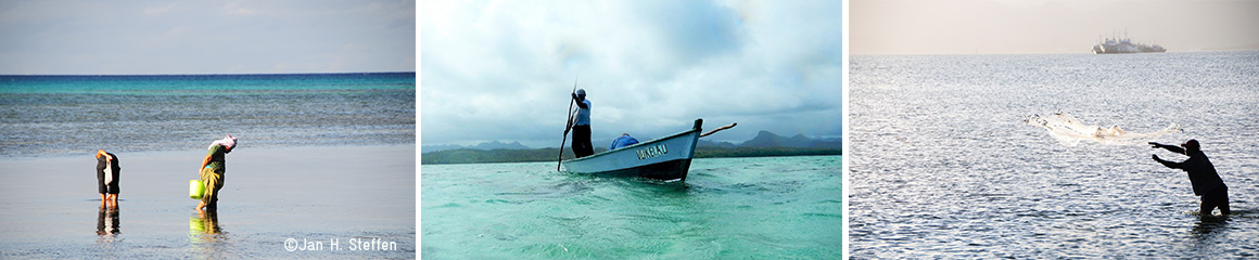
- Coastal residents in selected areas of the partner countries
- Staff of environmental and sectoral ministries (e.g. fisheries, planning, finance) at (sub) national level
- Members and staff of environmental NGOs
- Representatives of the Locally Managed Marine Areas Network (LMMA)
PROJECT DESCRIPTION
Managing Marine Biodiversity
By strengthening institutional and individual capacity to manage and conserve biodiversity in marine and coastal ecosystems, MACBIO supports sustainable economies and livelihoods of Pacific Island Countries.
Assisting Island Countries
The project is assisting its partner countries to meet their national biodiversity targets, as set out in their NBSAPs and the 2011-2020 Strategic Plan of the Convention on Biological Diversity.
Valuing
MACBIO is undertaking economic assessments of marine and coastal ecosystem services, and supports the integration of results into national policies and development planning.
Marine Ecosystem Services are often initially invisible and unrecognized, can reach the scale of national GDP value and need to be sustainably explored, managed and conserved.
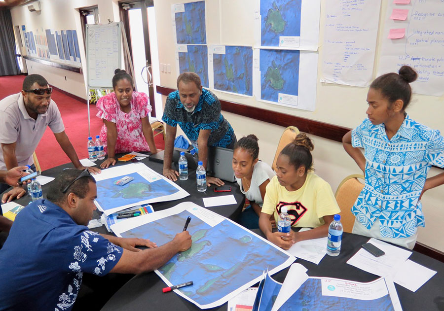
Planning
MACBIO supports partner countries in collecting and analyzing spatial data on different forms of current and future marine resource use, establishing a baseline for national sustainable development planning.
Aiming for integrated ocean management, marine spatial planning facilitates the sustainable use and conservation of marine and coastal ecosystems and habitats.
Marine Spatial Planning is an inter-sectoral and participatory planning process and tool that seeks to balance ecological, economic, and social objectives, aiming for sustainable marine resource use and prosperous blue economies.
Managing
MACBIO collaborates with national and regional stakeholders to document effective approaches towards sustainable marine resource management and conservation.The project encourages and supports stakeholders to share tried and tested concepts and instruments more widely throughout partner countries and the Oceania region.
MACBIO is facilitating stakeholder-based efforts, to document and disseminate lessons learnt, from Learning, Demonstration and Integration Sites.
SUCCESS STORIES
 To sustainably manage and protect their marine biodiversity, Pacific Island States have an appetite for open source geographic information systems and related planning tools. A new “cookbook”, developed by the MACBIO project, provides a free training hub and community of practice for spatial planning practitioners in the Pacific.
Based on the open-source application QGIS, the “QBook” training hub is a free, dynamic, MOODLE-based, on and offline learning platform that provides easy access to training materials for GIS beginners and practitioners, who are interested to increase their capacities and share their experience.
The QBook connects students and lecturers, regional agencies, NGOs, government departments and the private sector and allows beginning as well as experienced GIS practitioners to find and share solutions and “recipes” for a wide range of spatial data analysis and management situations. It offers regional and national solutions and scenarios and makes them relevant and relatable to its users.
QUOTES
“An NGO working in Fiji presented a question on the QBook on how communities can best be empowered to map their own natural resources. We responded with a community-based mapping guide that has now been integrated and reaches a much wider audience through the QBook platform. The diversity of user cases on the QBook highlights the need and potential for constructive exchanges across sectors on planning challenges and solutions. Through close collaboration with a growing range of partner organisations and an increasing number of users, the QBook provides a lively platform for all users of spatial data applications throughout the Pacific.
Give someone a fish and you feed him for a day, teach someone to fish and you feed him for a lifetime…”
(Lecturer and students of the University of the South Pacific)
TO LEARN MORE
VIDEO
PUBLICATIONS
- ASSISTING ISLAND COUNTRIES
- Explore Marine Ecosystem Service Values
- Vanuatu’s National Ocean Policy
- NATIONAL MARINE ECOSYSTEM SERVICE VALUATION KIRIBATI
- NATIONAL MARINE ECOSYSTEM SERVICE VALUATION solomon islands
- NATIONAL MARINE ECOSYSTEM SERVICE VALUATION TONGA
- NATIONAL MARINE ECOSYSTEM SERVICE VALUATION VANUATU
- NATIONAL MARINE ECOSYSTEM SERVICE VALUATION Fiji
COUNTRY
Pacific Island Countries
DURATION
Feb 2013 - May 2018
Commission Agency
BMUV