Berau secures forest areas while improving palm oil plantations governance
Berau District Government demonstrates their commitment to saving high conservation value areas while improving the sustainability of the palm oil sector. Through the Low-emissions oil palm development project (LEOPALD), GIZ and The Nature Conservancy have been supporting the Berau District Government in improving land use governance of the plantation sector.
Following the guidance from the East Kalimantan Province Government, and with technical assistance from the project, Berau District Government identified 83,000 ha of forested land as indicative high-conservation-value (HCV) areas. The district head formalizes the indicative area map through a decree No.287/2020 dated 20 April 2020, which stipulate that the relevant district government agencies shall monitor the protection of the areas and consider the indicative area—according to the map—when reviewing land-use related permit applications.
The indicative HCV area map is included in the geoportal data platform and linked to the web-based land suitability tool as a preliminary step in the business licensing process. This integration is necessary to incorporate HCV area assessment into the business licensing process.
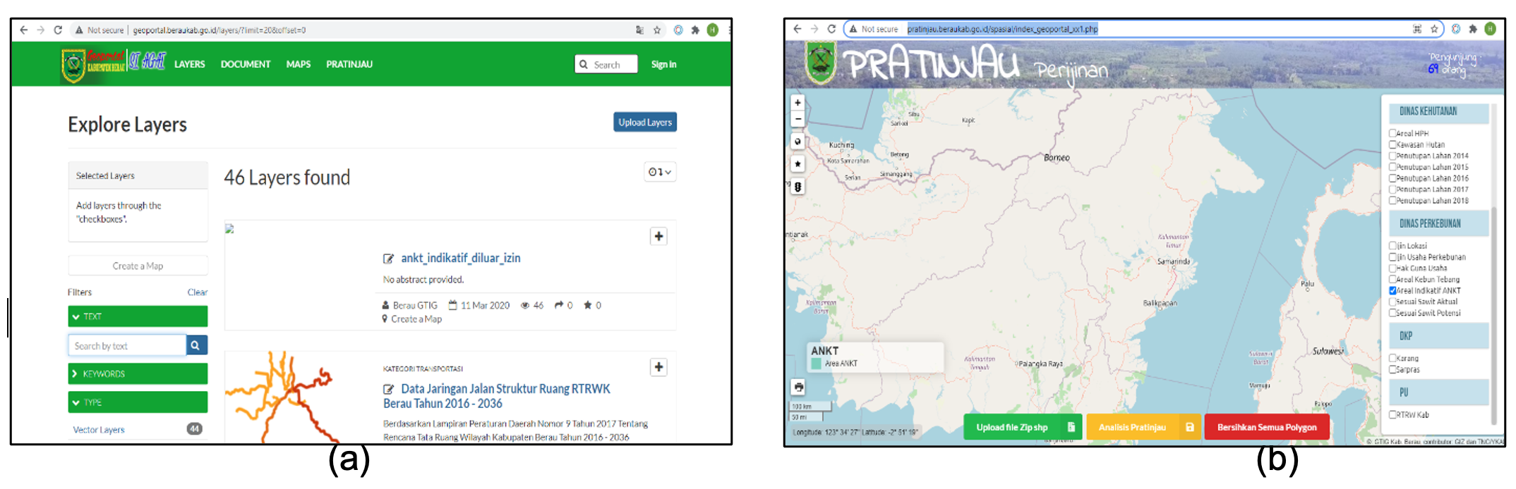
The web-based land suitability tool helps the district government and permit applications to assess the suitability of prospective land for new plantation development according to the agreed screening variables, including spatial plan, biophysical suitability, community land-use plan, existing permits, and the indicative HCV areas. By applying the tool, the applicants will be able to select fertile land to grow and avoid possible conflicts with other permits and local communities while also detecting potential HCV areas. If the prospective land for new development overlaps with the indicative HCV areas, the permit applicant shall perform the site-level HCV assessment.
The indicative map is incorporated into the Berau District Sustainable Plantation Plan 2021-2045, which is necessary to ensure the alignment of the protection plan with the production plan. The plan outlines spatial guidance for plantation development in the district. Under the leadership of the district government, responsibilities for managing and monitoring the indicative HCV areas are shared between government, companies and village communities.
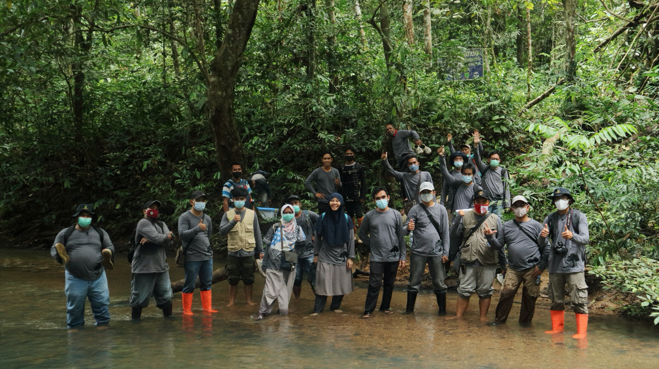
Furthermore, the indicative HCV map is also being synchronised with the village land-use plan. With support from the project, the estate crop office of the district government visited and discussed the indicative map with selected ten villages whose territory overlaps the indicative HCV areas. The project supports site-level HCV assessment in five of the ten villages that represent the socio-ecological characteristics of the district plantation zone to validate the district-wide indicative map. Local government officers and activist of local government organizations participated in the site-level HCV identification through on-the-job training. The result of the site-level HCV assessment will be used to formulate the management plan for the indicative HCV area in the plantation zone of the district.
Contact person:
Ade Cahyat, Principal Advisor GIZ Indonesia – ade.cahyat@giz.de
Tags:
palm oil, biodiversity, high conservation value