Land Management and Decentralised Planning (LMDP)

OBJECTIVES
Government authorities in Laos are capable of using land-use planning instruments to manage natural resources and to prevent and solve conflict over land
DESCRIPTION
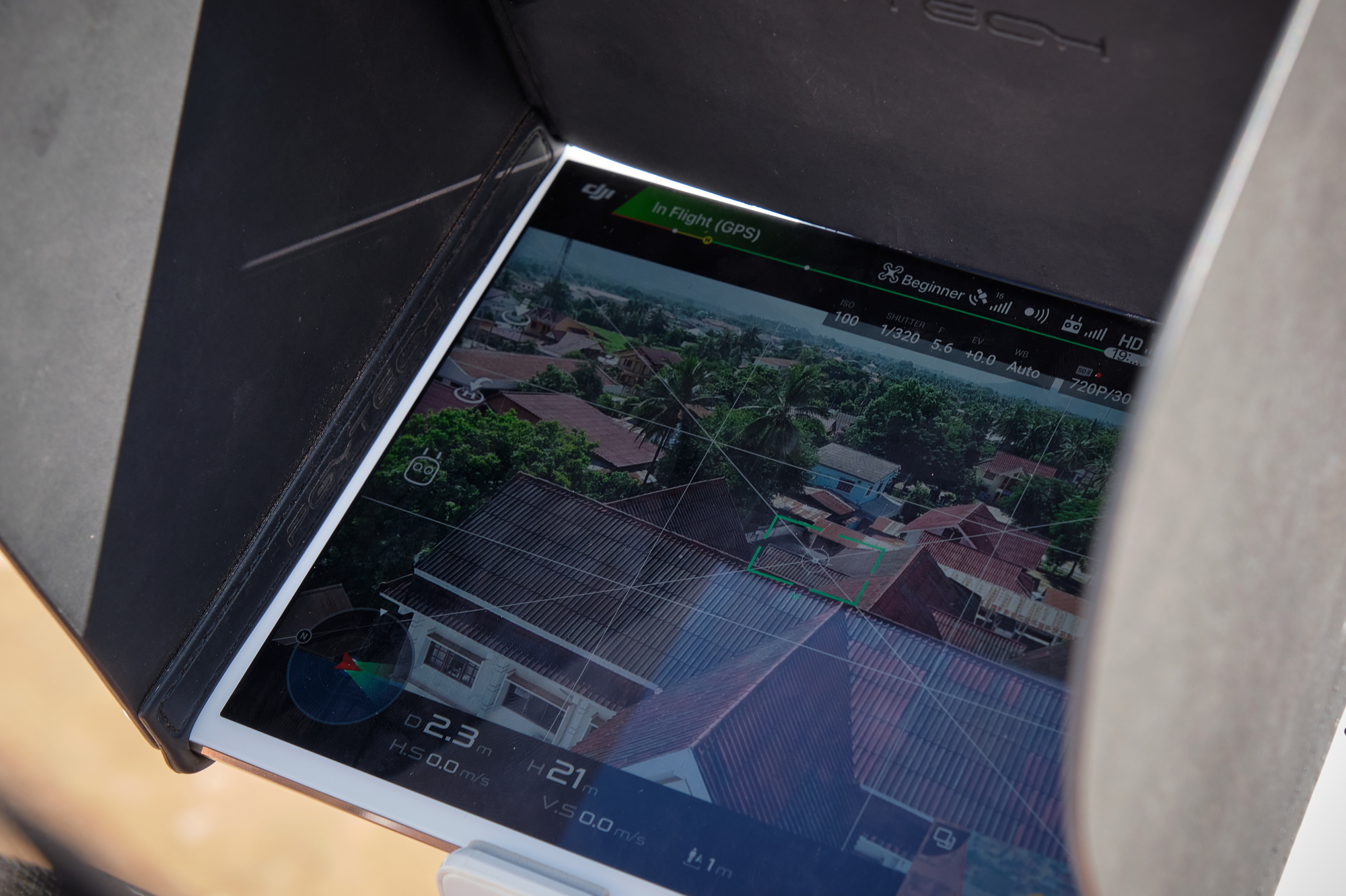
From 2015 – 2019 the projects LMDP 1+2 together with the partners developed tools to improve land use planning and land management in Laos. These are for example the digital cadastre system LaoLandReg, the land information system LUIS or the Area Physical Framework (APF) for land zonation, among others. The current phase of the project (LMDP 3) now focusses on the institutionalization and further technical expansion of these tools. To further integrate those into the partner structures, capacity building measures are a key feature to enable the partners to apply the tools in their standard work processes. Training courses are organized at provincial and district level to strengthen technical expertise in software development and to elaborate the understanding of procedural issues. In addition, trainings on technical tools for spatial planning like GIS and UAV-drones are conducted. The project collaborates closely with academic and state training institutions to successfully train multiplicators and to develop standardized curricula on the methods and instruments for sustainable land management.
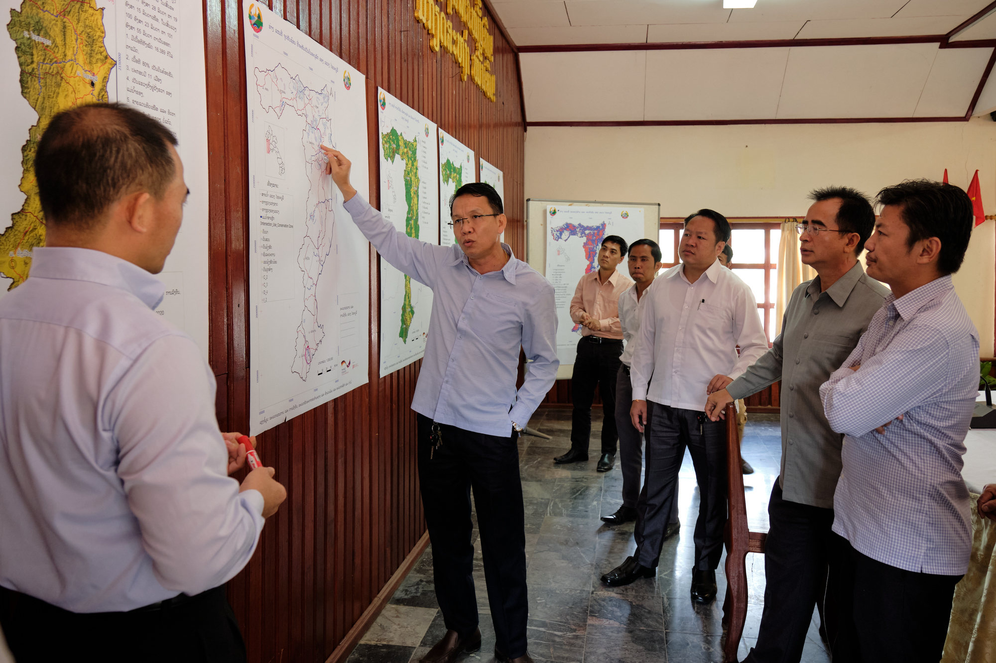
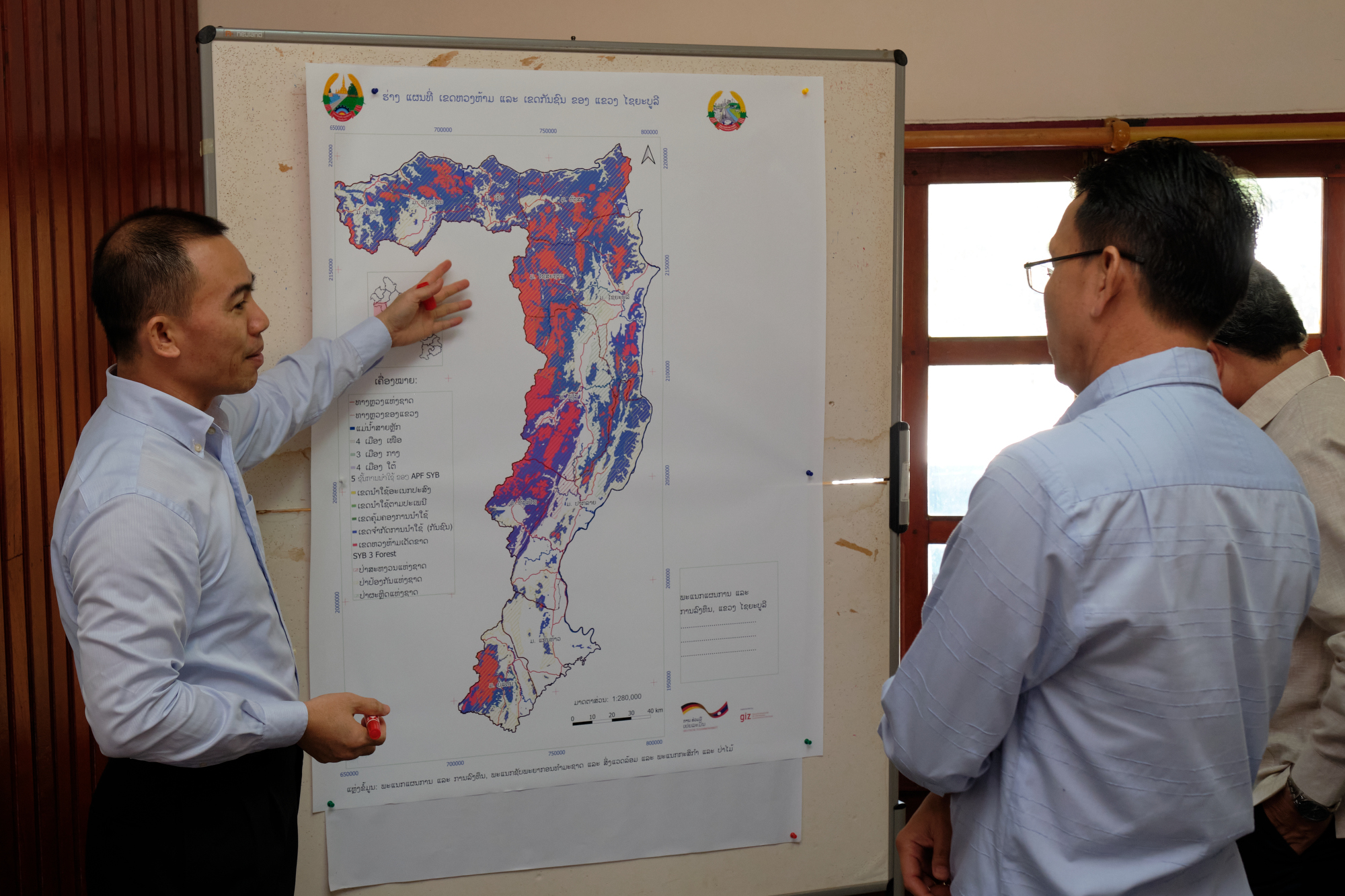
Procedures and instruments are applied in the pilot province Sayabouri and feed into the development of guidelines and manuals. Moreover, results are incorporated into the provincial socio-economic development planning (PSEDP) as well as the national socio-economic development planning (NSEDP).
Policy dialogue is taking place between government partners and other donors on all related topics of good governance in land and strengthened through the coordination of the Sub-Sector Working Group on Land among other exchange formats.
APPROACH/FIELD OF INTERVENTION
- Database management
- Land-use planning and management
- Digital land registration system (LaoLandReg)
TARGETED BENEFICIARIES
HIGHLIGHT ACTIVITIES
- Spatial planning at provincial and district level
- Capacity development measures of provincial and district authorities
- Development of manuals and guidelines for spatial planning, land allocation planning, remote sensing and UAV-Drone technology
- Further expansion the digital cadaster system LaoLandReg to enable nationwide land registrations in Laos
- Further development and finetuning of the land information system LUIS
- Technical guidance to improve linkages between the digital cadaster for land registration (LaoLandReg) and other relevant data bases
PUBLICATIONS
- Land Management and Decentralised Planning 3 (ENG)
- Land Management and Decentralised Planning 3 (LAO)
- GIZ Good Practice Laos
VIDEO
COUNTRY
Laos , Asia
DURATION
2019 - 2023
Commission Agency
BMZ
SDG


WEBSITE
Improving land use in Laos (giz.de)